FEMA tweaks to flood maps could affect Troup County homeowners

Published 12:00 am Wednesday, August 19, 2015
Insurance premiums could change for homeowners

By Tyler H. Jones

tjones@civitasmedia.com

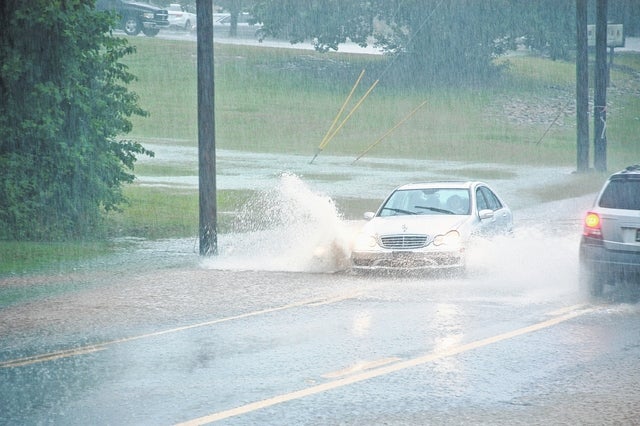
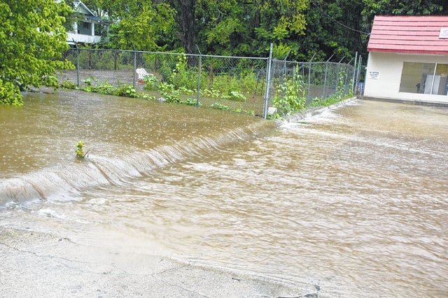
Water pours down Ashton Street next to Self Service Laundry during heavy rains that caused flooding on July 3, 2013. FEMA and state officials are slated to hold a meeting and open house Thursday to discuss upcoming tweaks to the government-issued Flood Insurance Rate Map, or FIRM, of Troup County and the surrounding areas.

http://lagrangenews.com/wp-content/uploads/sites/37/2015/08/web1_0819FILEFlooding01.jpgWater pours down Ashton Street next to Self Service Laundry during heavy rains that caused flooding on July 3, 2013. FEMA and state officials are slated to hold a meeting and open house Thursday to discuss upcoming tweaks to the government-issued Flood Insurance Rate Map, or FIRM, of Troup County and the surrounding areas.

File photo

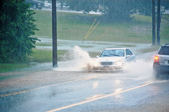
Cars traverse the deep water in spots of Whitesville Street during flooding on July 3, 2013. Heavy rains on that day caused flash flooding around Troup County.

http://lagrangenews.com/wp-content/uploads/sites/37/2015/08/web1_0819FILEFlooding02.jpgCars traverse the deep water in spots of Whitesville Street during flooding on July 3, 2013. Heavy rains on that day caused flash flooding around Troup County.

File photo

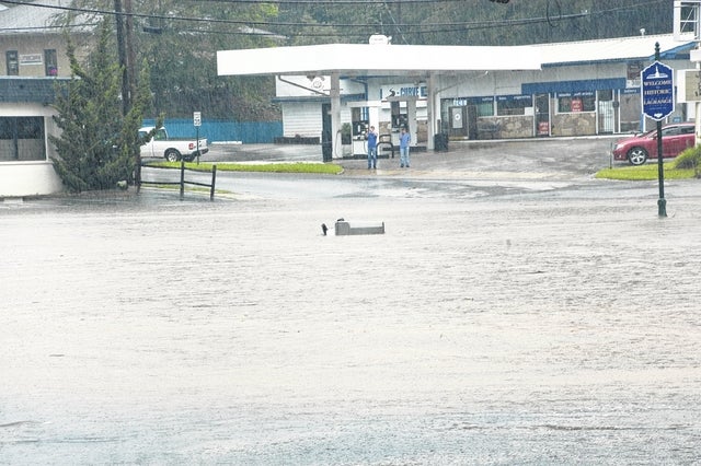
The intersection of Ashton and South Greenwood streets is shown partially under water during flooding July 3, 2013. The water was deep enough to send garbage containers afloat.

http://lagrangenews.com/wp-content/uploads/sites/37/2015/08/web1_0819FILEFlooding03.jpgThe intersection of Ashton and South Greenwood streets is shown partially under water during flooding July 3, 2013. The water was deep enough to send garbage containers afloat.

File photo

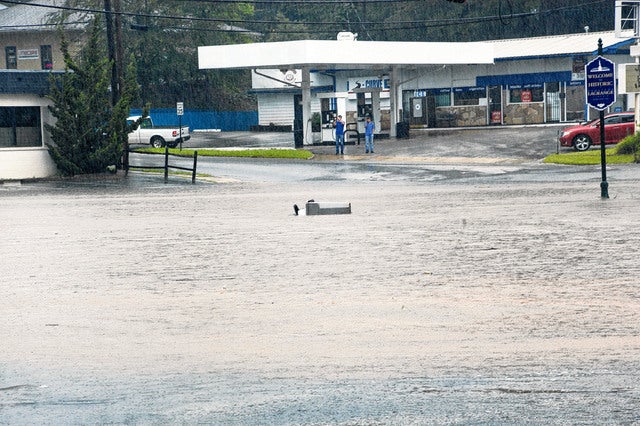
The intersection of Ashton and South Greenwood streets is shown partially under water during flooding July 3, 2013. The water was deep enough to send garbage containers afloat.

http://lagrangenews.com/wp-content/uploads/sites/37/2015/08/web1_WEB0819FILEFlooding03.jpgThe intersection of Ashton and South Greenwood streets is shown partially under water during flooding July 3, 2013. The water was deep enough to send garbage containers afloat.

File photo

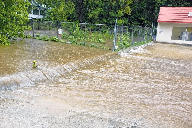
Water pours down Ashton Street next to Self Service Laundry during heavy rains that caused flooding on July 3, 2013. FEMA and state officials are slated to hold a meeting and open house Thursday to discuss upcoming tweaks to the government-issued Flood Insurance Rate Map, or FIRM, of Troup County and the surrounding areas.

http://lagrangenews.com/wp-content/uploads/sites/37/2015/08/web1_WEB0819FILEFlooding01.jpgWater pours down Ashton Street next to Self Service Laundry during heavy rains that caused flooding on July 3, 2013. FEMA and state officials are slated to hold a meeting and open house Thursday to discuss upcoming tweaks to the government-issued Flood Insurance Rate Map, or FIRM, of Troup County and the surrounding areas.

File photo

Cars traverse the deep water in spots of Whitesville Street during flooding on July 3, 2013. Heavy rains on that day caused flash flooding around Troup County.

http://lagrangenews.com/wp-content/uploads/sites/37/2015/08/web1_WEB0819FILEFlooding02.jpgCars traverse the deep water in spots of Whitesville Street during flooding on July 3, 2013. Heavy rains on that day caused flash flooding around Troup County.

File photo

LaGRANGE — Upcoming changes to a government map may impact insurance premiums for some Troup County residents.

The Federal Emergency Management Agency, or FEMA, and state officials are slated to hold a meeting and open house Thursday to discuss upcoming tweaks to the government-issued Flood Insurance Rate Map, or FIRM, of Troup County and the surrounding areas.

The meeting is open to the public and scheduled for 5 p.m. to 7:30 p.m. at the Troup County Agricultural Center, 21 Vulcan Materials Road, in LaGrange. Community leaders, insurance representatives, FEMA agents and the floodplain study’s contract engineer will be available to answer questions in an informal setting, according to a press release from FEMA.

The FIRM is used to determine a community’s base flood elevations, flood zones and floodplain boundaries. The map provides homeowners with reliable, data-driven indications of what flood stage their property may sit in.

“If they (homes) are prone to potential flooding, they (homeowners) could maybe do something to minimize damage or even loss of life,” said Jay Anderson, the Troup County government’s senior building official. “Anything they can do to be aware and minimize risk is to their advantage.”

Anderson explained that FEMA periodically updates the FIRM to reflect changes in “new studies, new engineering or new analysis.”

The revised study may result in increases or decreases to the regulatory flood elevations and the footprint of the floodplain boundaries, according to a letter from FEMA to Troup County officials. The map will act as the basis for the county’s continued application and enforcement of all local floodplain management regulations as required by the National Flood Insurance Program, a federally backed flood insurance program for homeowners, renters and businesses.

The preliminary flood map study will be subject to a 90-day review period of appeal and public comment. Appeals and comments received during that time will be reviewed and resolved by FEMA before a second, 180-day community compliance period begins. FEMA estimates it will take at least nine months from the date of the beginning of the 90-day review period before the FIRM is available for lending and insurance purposes.

Flooding is the nation’s most prolific natural disaster, causing an average of $2.39 billion in damages yearly between 1998 and 2007. More than 5.5 million Americans are enrolled in the National Flood Insurance Program, according to FEMA.

FloodSmart.gov is the official website of the National Flood Insurance Program and provides one-step flood risk profiles to rate a property’s risk, estimate premiums and help consumers find an insurance agent.

Tyler H. Jones is a reporter at LaGrange Daily News. He may be reached at 706-844-7311, ext. 2155.